

Key Insights
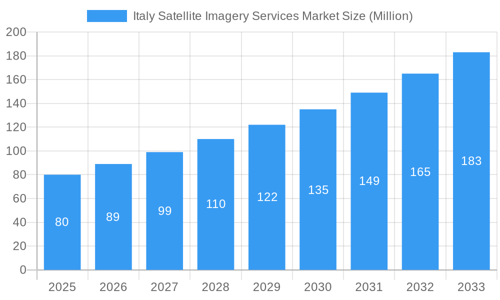
The Italian satellite imagery services market, valued at approximately €80 million in 2025, is projected to experience robust growth, exhibiting a Compound Annual Growth Rate (CAGR) of 10.89% from 2025 to 2033. This expansion is driven by increasing government investments in infrastructure development, particularly within the transportation and logistics sectors, coupled with a rising demand for precise geospatial data in construction projects and environmental monitoring. The adoption of satellite imagery for effective natural resource management, disaster response, and agricultural planning further fuels market growth. Key applications include geospatial data acquisition and mapping, natural resource management, surveillance and security, conservation and research, and disaster management. The government sector is a dominant end-user, followed by construction, transportation and logistics, and military and defense. Leading players such as e-GEOS, Geocento, Airbus, and Maxar Technologies are actively contributing to market expansion through technological advancements and strategic partnerships. However, factors such as high initial investment costs and the need for specialized expertise could potentially restrain market growth. Despite these challenges, the long-term outlook for the Italian satellite imagery services market remains positive, fueled by ongoing technological innovation and increasing government support for geospatial applications.
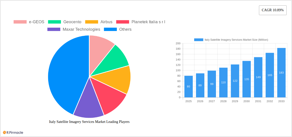
Italy Satellite Imagery Services Market Market Size (In Million)
The competitive landscape is characterized by a mix of international and domestic players, each offering specialized services catering to the diverse needs of various end-users. While international companies benefit from extensive experience and global technological advancements, domestic providers leverage their regional expertise and local knowledge to better serve Italian clients' specific requirements. The market’s future trajectory will likely be shaped by advancements in high-resolution imaging, the integration of Artificial Intelligence (AI) for advanced data analysis, and the growing availability of cloud-based platforms for efficient data management and processing. This will translate to increased accuracy, efficiency, and cost-effectiveness in providing satellite imagery services, further stimulating market growth in the coming years.
Italy Satellite Imagery Services Market Company Market Share
Italy Satellite Imagery Services Market Report: 2019-2033
This comprehensive report provides an in-depth analysis of the Italy Satellite Imagery Services Market, offering invaluable insights for industry professionals, investors, and strategic decision-makers. With a focus on market dynamics, competitive landscape, and future growth projections, this report covers the period from 2019 to 2033, with a base year of 2025. The report leverages a combination of qualitative and quantitative analysis to provide actionable intelligence for navigating this dynamic market.
Italy Satellite Imagery Services Market Structure & Innovation Trends
The Italian satellite imagery services market exhibits a moderately consolidated structure, with key players such as e-GEOS, Geocento, Airbus, Planetek Italia s.r.l., Maxar Technologies, L3Harris Technologies, Viasat Group S.p.A, EUSI, Thales Alenia Space, and OHB-Italia S.p.A. holding significant market share. However, the presence of numerous smaller, specialized firms indicates a competitive landscape with opportunities for both established players and new entrants. Market share distribution is estimated at xx% for the top 5 players in 2025, with the remaining share distributed amongst smaller companies and niche players.
Innovation is driven by advancements in sensor technology, increased processing power, and the development of advanced analytical capabilities. Regulatory frameworks, including those related to data privacy and national security, significantly influence market operations. The market witnesses continuous innovation in areas such as high-resolution imagery, AI-powered image analysis, and the integration of various data sources. Substitute technologies, such as aerial photography, are present, but satellite imagery maintains a competitive edge due to its wide coverage and cost-effectiveness for large-scale projects.
M&A activity in the Italian satellite imagery sector remains relatively moderate, with estimated deal values totaling xx Million in the last five years. These activities predominantly focus on enhancing technological capabilities, expanding service portfolios, and accessing new markets. The overall end-user demographic is diverse, encompassing government agencies, private companies, and research institutions.
- Market Concentration: Moderately Consolidated
- Key Players: e-GEOS, Geocento, Airbus, Planetek Italia s.r.l., Maxar Technologies, L3Harris Technologies, Viasat Group S.p.A, EUSI, Thales Alenia Space, OHB-Italia S.p.A.
- Innovation Drivers: Sensor technology, AI-powered analytics, data integration.
- Regulatory Influence: Significant impact on data privacy and national security.
- M&A Activity: Moderate, focused on technological enhancement and market expansion.
Italy Satellite Imagery Services Market Dynamics & Trends
The Italy Satellite Imagery Services Market is experiencing robust growth, driven primarily by increasing demand from government agencies for surveillance and security applications, the growing adoption of satellite imagery for natural resource management and precision agriculture, and expanding construction and infrastructure development. The market is expected to witness a Compound Annual Growth Rate (CAGR) of xx% during the forecast period (2025-2033). Market penetration, particularly in the private sector, continues to rise as the cost of satellite imagery decreases and its accessibility improves.
Technological disruptions, including advancements in high-resolution sensors, cloud-based processing platforms, and AI-driven analytics, significantly enhance the efficiency and effectiveness of satellite imagery solutions. Consumer preferences are shifting towards higher-resolution data, faster processing times, and value-added services, prompting providers to invest in cutting-edge technologies.
Competitive dynamics are characterized by both cooperation and competition. Strategic alliances and partnerships are increasingly common, particularly for large-scale projects requiring integrated solutions. Simultaneously, intense competition drives innovation and price optimization, benefiting end-users.
Dominant Regions & Segments in Italy Satellite Imagery Services Market
The Northern region of Italy holds the largest market share due to the concentration of industrial activities, higher technological adoption rates, and a well-established infrastructure. However, growth is anticipated across all regions as the awareness of satellite imagery applications increases.
By Application:
- Geospatial Data Acquisition and Mapping: This segment dominates the market, driven by substantial government investments in infrastructure projects and urban planning initiatives.
- Surveillance and Security: Strong government demand drives substantial market share, particularly for national security and border control purposes.
- Natural Resource Management: Increasing awareness of environmental issues and the need for precise monitoring fuels growth in this segment.
By End-User:
- Government: The government sector is the largest end-user, particularly through its various agencies involved in surveillance, environmental monitoring, and infrastructure development.
- Construction: This sector displays strong growth potential, leveraging satellite imagery for project planning, site monitoring, and risk assessment.
Key drivers for dominance in specific segments include:
- Government: Strong public investment in infrastructure and security initiatives.
- Construction: Increased use of satellite-based monitoring and project planning tools.
- Agriculture: Adoption of precision agriculture techniques requiring accurate and timely data.
Italy Satellite Imagery Services Market Product Innovations
Recent product innovations focus on enhancing image resolution, improving processing speeds, and developing advanced analytical tools. The integration of AI and machine learning algorithms allows for automated image analysis, extracting valuable insights from satellite imagery more efficiently. These innovations improve the market fit by providing more cost-effective and accurate solutions for various applications, such as precision agriculture and urban planning. The development of cloud-based platforms enables easier access and scalability, thereby contributing to wider adoption.
Report Scope & Segmentation Analysis
This report segments the Italian satellite imagery services market by application (Geospatial Data Acquisition and Mapping, Natural Resource Management, Surveillance and Security, Conservation and Research, Disaster Management, Intelligence) and end-user (Government, Construction, Transportation and Logistics, Military and Defense, Forestry and Agriculture, Others). Each segment is analyzed based on its current market size, growth projections, and competitive dynamics. Growth projections vary significantly across segments, with sectors like Surveillance and Security and Geospatial Data Acquisition and Mapping experiencing particularly strong growth due to increased government spending and infrastructure development. Competitive dynamics are influenced by the concentration of players and their specific expertise within each segment.
Key Drivers of Italy Satellite Imagery Services Market Growth
Several key factors propel the growth of the Italy Satellite Imagery Services Market. These include:
- Government initiatives: Increased investment in infrastructure projects and national security programs.
- Technological advancements: The continuous development of higher-resolution sensors and AI-powered image analysis.
- Growing private sector adoption: Increased demand for precise geospatial data from industries such as construction, agriculture, and insurance.
- Environmental monitoring: The rising need for accurate and timely data to monitor environmental changes and manage natural resources.
Challenges in the Italy Satellite Imagery Services Market Sector
The Italian satellite imagery services market faces several challenges:
- Data privacy concerns: Stringent regulations regarding the collection and use of geospatial data can limit market expansion.
- High initial investment costs: The high cost of satellite acquisition and maintenance can deter smaller companies from entering the market.
- Competition from international providers: The market faces competition from global players with significant resources and experience.
- Dependence on external factors: Events like natural disasters can create data gaps and affect data collection.
Emerging Opportunities in Italy Satellite Imagery Services Market
Several emerging opportunities exist for growth in the Italian satellite imagery market:
- Integration of IoT and AI: The combination of satellite imagery with data from IoT devices can provide comprehensive insights into various sectors.
- Growth in the private sector: Expanding the user base beyond government agencies towards private companies can create new revenue streams.
- Development of niche applications: Focusing on specific industry needs and tailoring products to specific market segments.
- International collaborations: Developing collaborations with other European countries to leverage expertise and resources can open new market opportunities.
Leading Players in the Italy Satellite Imagery Services Market Market
- e-GEOS
- Geocento
- Airbus
- Planetek Italia s.r.l.
- Maxar Technologies
- L3Harris Technologies
- Viasat Group S.p.A
- EUSI
- Thales Alenia Space
- OHB-Italia S.p.A
Key Developments in Italy Satellite Imagery Services Market Industry
- March 2023: Arianespace secured a contract with ESA (on behalf of the Italian government) to launch the IRIDE constellation (36 satellites) starting late 2025. This signifies a major investment in the Italian space sector and will significantly increase the volume of imagery available.
- October 2022: Sentinel-2's rapid capture of Stromboli's eruption highlighted the value of satellite imagery for real-time disaster monitoring and response, likely boosting demand for rapid response capabilities.
Future Outlook for Italy Satellite Imagery Services Market Market
The future outlook for the Italy Satellite Imagery Services Market is highly positive. Continued government investment, technological advancements, and increasing private sector adoption will drive substantial market growth. Strategic partnerships and collaborations will be key to success, enabling companies to offer integrated and innovative solutions to a wider range of users. The market is expected to expand significantly, driven by new applications, improved technologies, and a growing awareness of the benefits of satellite imagery.
Italy Satellite Imagery Services Market Segmentation
-
1. Application
- 1.1. Geospatial Data Acquisition and Mapping
- 1.2. Natural Resource Management
- 1.3. Surveillance and Security
- 1.4. Conservation and Research
- 1.5. Disaster Management
- 1.6. Intelligence
-
2. End-User
- 2.1. Government
- 2.2. Construction
- 2.3. Transportation and Logistics
- 2.4. Military and Defense
- 2.5. Forestry and Agriculture
- 2.6. Others
Italy Satellite Imagery Services Market Segmentation By Geography
- 1. Italy
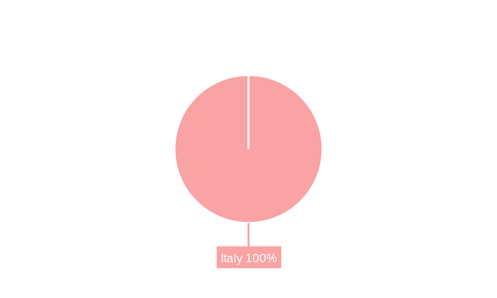
Italy Satellite Imagery Services Market Regional Market Share
Geographic Coverage of Italy Satellite Imagery Services Market
Italy Satellite Imagery Services Market REPORT HIGHLIGHTS
| Aspects | Details |
|---|---|
| Study Period | 2020-2034 |
| Base Year | 2025 |
| Estimated Year | 2026 |
| Forecast Period | 2026-2034 |
| Historical Period | 2020-2025 |
| Growth Rate | CAGR of 10% from 2020-2034 |
| Segmentation |
|
Table of Contents
- 1. Introduction
- 1.1. Research Scope
- 1.2. Market Segmentation
- 1.3. Research Objective
- 1.4. Definitions and Assumptions
- 2. Executive Summary
- 2.1. Market Snapshot
- 3. Market Dynamics
- 3.1. Market Drivers
- 3.2. Market Restrains
- 3.3. Market Trends
- 3.4. Market Opportunities
- 4. Market Factor Analysis
- 4.1. Porters Five Forces
- 4.1.1. Bargaining Power of Suppliers
- 4.1.2. Bargaining Power of Buyers
- 4.1.3. Threat of New Entrants
- 4.1.4. Threat of Substitutes
- 4.1.5. Competitive Rivalry
- 4.2. PESTEL analysis
- 4.3. BCG Analysis
- 4.3.1. Stars (High Growth, High Market Share)
- 4.3.2. Cash Cows (Low Growth, High Market Share)
- 4.3.3. Question Mark (High Growth, Low Market Share)
- 4.3.4. Dogs (Low Growth, Low Market Share)
- 4.4. Ansoff Matrix Analysis
- 4.5. Supply Chain Analysis
- 4.6. Regulatory Landscape
- 4.7. Current Market Potential and Opportunity Assessment (TAM–SAM–SOM Framework)
- 4.8. PRI Analyst Note
- 4.1. Porters Five Forces
- 5. Market Analysis, Insights and Forecast 2021-2033
- 5.1. Market Analysis, Insights and Forecast - by Application
- 5.1.1. Geospatial Data Acquisition and Mapping
- 5.1.2. Natural Resource Management
- 5.1.3. Surveillance and Security
- 5.1.4. Conservation and Research
- 5.1.5. Disaster Management
- 5.1.6. Intelligence
- 5.2. Market Analysis, Insights and Forecast - by End-User
- 5.2.1. Government
- 5.2.2. Construction
- 5.2.3. Transportation and Logistics
- 5.2.4. Military and Defense
- 5.2.5. Forestry and Agriculture
- 5.2.6. Others
- 5.3. Market Analysis, Insights and Forecast - by Region
- 5.3.1. Italy
- 5.1. Market Analysis, Insights and Forecast - by Application
- 6. Italy Satellite Imagery Services Market Analysis, Insights and Forecast, 2021-2033
- 6.1. Market Analysis, Insights and Forecast - by Application
- 6.1.1. Geospatial Data Acquisition and Mapping
- 6.1.2. Natural Resource Management
- 6.1.3. Surveillance and Security
- 6.1.4. Conservation and Research
- 6.1.5. Disaster Management
- 6.1.6. Intelligence
- 6.2. Market Analysis, Insights and Forecast - by End-User
- 6.2.1. Government
- 6.2.2. Construction
- 6.2.3. Transportation and Logistics
- 6.2.4. Military and Defense
- 6.2.5. Forestry and Agriculture
- 6.2.6. Others
- 6.1. Market Analysis, Insights and Forecast - by Application
- 7. Competitive Analysis
- 7.1. Company Profiles
- 7.1.1 e-GEOS
- 7.1.1.1. Company Overview
- 7.1.1.2. Products
- 7.1.1.3. Company Financials
- 7.1.1.4. SWOT Analysis
- 7.1.2 Geocento
- 7.1.2.1. Company Overview
- 7.1.2.2. Products
- 7.1.2.3. Company Financials
- 7.1.2.4. SWOT Analysis
- 7.1.3 Airbus
- 7.1.3.1. Company Overview
- 7.1.3.2. Products
- 7.1.3.3. Company Financials
- 7.1.3.4. SWOT Analysis
- 7.1.4 Planetek Italia s r l
- 7.1.4.1. Company Overview
- 7.1.4.2. Products
- 7.1.4.3. Company Financials
- 7.1.4.4. SWOT Analysis
- 7.1.5 Maxar Technologies
- 7.1.5.1. Company Overview
- 7.1.5.2. Products
- 7.1.5.3. Company Financials
- 7.1.5.4. SWOT Analysis
- 7.1.6 L3Harris Technologies*List Not Exhaustive
- 7.1.6.1. Company Overview
- 7.1.6.2. Products
- 7.1.6.3. Company Financials
- 7.1.6.4. SWOT Analysis
- 7.1.7 Viasat Group S p A
- 7.1.7.1. Company Overview
- 7.1.7.2. Products
- 7.1.7.3. Company Financials
- 7.1.7.4. SWOT Analysis
- 7.1.8 EUSI
- 7.1.8.1. Company Overview
- 7.1.8.2. Products
- 7.1.8.3. Company Financials
- 7.1.8.4. SWOT Analysis
- 7.1.9 Thales Alenia Space
- 7.1.9.1. Company Overview
- 7.1.9.2. Products
- 7.1.9.3. Company Financials
- 7.1.9.4. SWOT Analysis
- 7.1.10 OHB-Italia S p A
- 7.1.10.1. Company Overview
- 7.1.10.2. Products
- 7.1.10.3. Company Financials
- 7.1.10.4. SWOT Analysis
- 7.1.1 e-GEOS
- 7.2. Market Entropy
- 7.2.1 Company's Key Areas Served
- 7.2.2 Recent Developments
- 7.3. Company Market Share Analysis 2025
- 7.3.1 Top 5 Companies Market Share Analysis
- 7.3.2 Top 3 Companies Market Share Analysis
- 7.4. List of Potential Customers
- 8. Research Methodology
List of Figures
- Figure 1: Italy Satellite Imagery Services Market Revenue Breakdown (billion, %) by Product 2025 & 2033
- Figure 2: Italy Satellite Imagery Services Market Share (%) by Company 2025
List of Tables
- Table 1: Italy Satellite Imagery Services Market Revenue billion Forecast, by Application 2020 & 2033
- Table 2: Italy Satellite Imagery Services Market Revenue billion Forecast, by End-User 2020 & 2033
- Table 3: Italy Satellite Imagery Services Market Revenue billion Forecast, by Region 2020 & 2033
- Table 4: Italy Satellite Imagery Services Market Revenue billion Forecast, by Application 2020 & 2033
- Table 5: Italy Satellite Imagery Services Market Revenue billion Forecast, by End-User 2020 & 2033
- Table 6: Italy Satellite Imagery Services Market Revenue billion Forecast, by Country 2020 & 2033
Frequently Asked Questions
1. What is the projected Compound Annual Growth Rate (CAGR) of the Italy Satellite Imagery Services Market?
The projected CAGR is approximately 10%.
2. Which companies are prominent players in the Italy Satellite Imagery Services Market?
Key companies in the market include e-GEOS, Geocento, Airbus, Planetek Italia s r l, Maxar Technologies, L3Harris Technologies*List Not Exhaustive, Viasat Group S p A, EUSI, Thales Alenia Space, OHB-Italia S p A.
3. What are the main segments of the Italy Satellite Imagery Services Market?
The market segments include Application, End-User.
4. Can you provide details about the market size?
The market size is estimated to be USD 2.83 billion as of 2022.
5. What are some drivers contributing to market growth?
Increasing Investments to Strengthen Country's Space Economy; Adoption of Big Data and Imagery Analytics.
6. What are the notable trends driving market growth?
Disaster Management Segment is Expected to Hold Significant Market Share.
7. Are there any restraints impacting market growth?
High Cost of Satellite Imaging Data Acquisition and Processing.
8. Can you provide examples of recent developments in the market?
March 2023: Arianespace announced signing a contract with the European Space Agency (ESA), acting on behalf of the Italian government, for launching the IRIDE constellation of imaging satellites. The agreement includes two firm Vega C launches, starting in late 2025, with an option for a third. The Italian government funds the IRIDE constellation. It will consist of 36 satellites built by a consortium of Italian companies equipped with various imaging payloads, including optical and radar.
9. What pricing options are available for accessing the report?
Pricing options include single-user, multi-user, and enterprise licenses priced at USD 3800, USD 4500, and USD 5800 respectively.
10. Is the market size provided in terms of value or volume?
The market size is provided in terms of value, measured in billion.
11. Are there any specific market keywords associated with the report?
Yes, the market keyword associated with the report is "Italy Satellite Imagery Services Market," which aids in identifying and referencing the specific market segment covered.
12. How do I determine which pricing option suits my needs best?
The pricing options vary based on user requirements and access needs. Individual users may opt for single-user licenses, while businesses requiring broader access may choose multi-user or enterprise licenses for cost-effective access to the report.
13. Are there any additional resources or data provided in the Italy Satellite Imagery Services Market report?
While the report offers comprehensive insights, it's advisable to review the specific contents or supplementary materials provided to ascertain if additional resources or data are available.
14. How can I stay updated on further developments or reports in the Italy Satellite Imagery Services Market?
To stay informed about further developments, trends, and reports in the Italy Satellite Imagery Services Market, consider subscribing to industry newsletters, following relevant companies and organizations, or regularly checking reputable industry news sources and publications.
Methodology
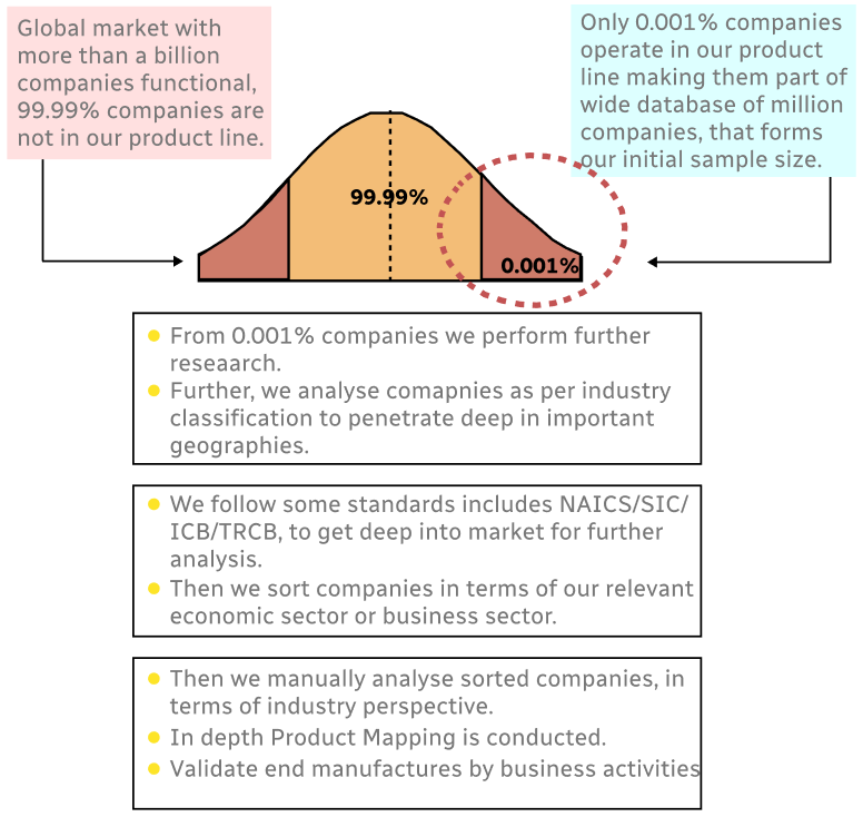
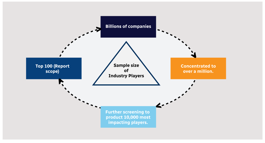
Step 1 - Identification of Relevant Samples Size from Population Database
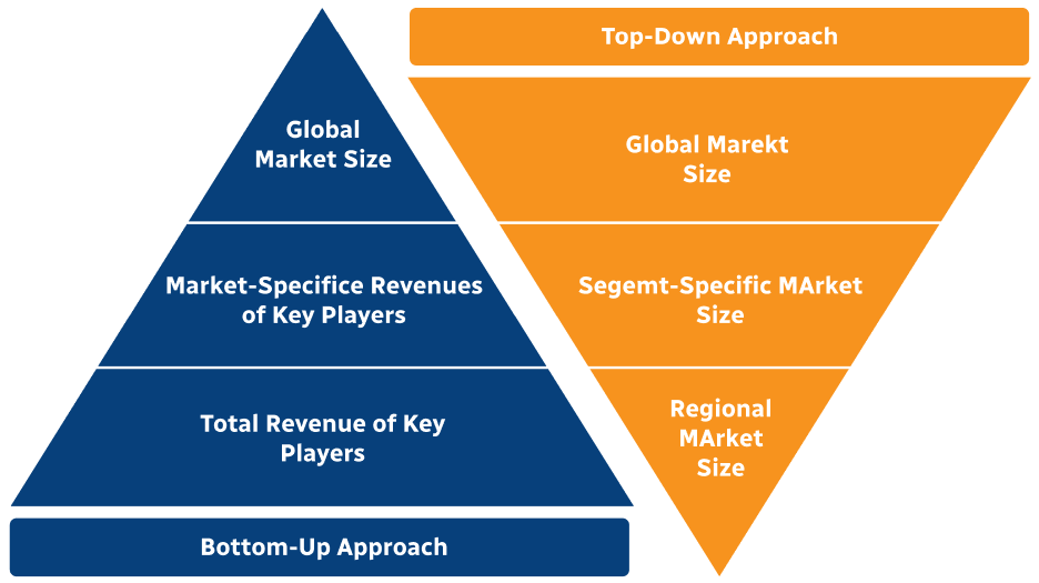
Step 2 - Approaches for Defining Global Market Size (Value, Volume* & Price*)
Note*: In applicable scenarios
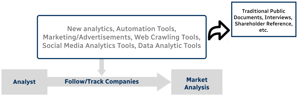
Step 3 - Data Sources
Primary Research
- Web Analytics
- Survey Reports
- Research Institute
- Latest Research Reports
- Opinion Leaders
Secondary Research
- Annual Reports
- White Paper
- Latest Press Release
- Industry Association
- Paid Database
- Investor Presentations
Step 4 - Data Triangulation
Involves using different sources of information in order to increase the validity of a study
These sources are likely to be stakeholders in a program - participants, other researchers, program staff, other community members, and so on.
Then we put all data in single framework & apply various statistical tools to find out the dynamic on the market.
During the analysis stage, feedback from the stakeholder groups would be compared to determine areas of agreement as well as areas of divergence